GPX comparison – Public & Scientific Applications Beyond Sports
- Mtb life
- January 12, 2025
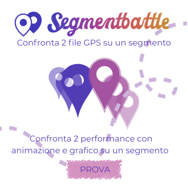
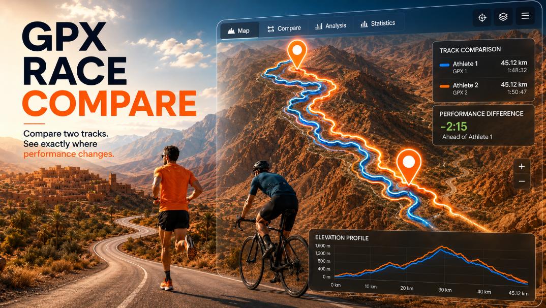
Segment Battle was originally designed to compare two GPX tracks on the same route for sports: running, cycling, trail running or coaching.
But its logic — synchronizing two GPS tracks along the same segment and visualizing differences in time, speed or position — makes it extremely useful in many public, scientific, urban and industrial contexts.
Here are the most interesting non-sport use cases.
🚆 1. Railway performance and delay analysis
Comparing two GPX tracks of a train running the same route on different days reveals:
- where delays accumulate
- which stations cause the biggest slowdown
- differences between scheduled vs. real travel time
- infrastructure bottlenecks
Perfect for public transport authorities or researchers studying rail punctuality.
🚗 2. Urban traffic comparison
Two GPX tracks of a car, bus or taxi traveling the same stretch can show:
- congestion hotspots
- differences between peak and off-peak
- the effect of traffic lights, roundabouts, and intersections
- impact of temporary works or diversions
A simple but powerful smart-mobility analysis tool.
🚑 3. Emergency response time evaluation
Fire trucks, ambulances or rescue units often follow the same route repeatedly.
Segment Battle can help identify:
- where precious seconds are lost
- which streets delay emergency vehicles
- whether route optimization improves response times
Useful for emergency services and civil protection.
🛣 4. Before/after infrastructure assessment
By comparing two tracks recorded:
- before and after a new roundabout
- before and after road widening
- before and after adding a bike lane
… it becomes clear whether infrastructure improvements actually reduce travel time.
This provides objective metrics for city planners.
📦 5. Logistics and delivery optimization
Courier companies or fleet managers can compare two delivery routes:
- two drivers on the same path
- two different days
- two different traffic conditions
This helps identify inefficiencies or highlight where time is wasted.
🐾 6. Wildlife tracking and movement studies
Researchers tracking animals with GPS collars can compare:
- movement patterns of two animals on the same trail
- seasonal differences
- responses to environmental changes
Useful for ecology, conservation and animal behavior studies.
🏔 7. Environmental change and land deformation
Scientists performing field surveys can compare two GPX tracks of the same natural trail to detect:
- landslides
- erosion
- newly formed obstacles
- changes in riverbeds or slopes
A practical tool for geomorphology and environmental monitoring.
🚁 8. Drone flight precision and performance
For robotics research or aerial inspection:
- compare two drone flights along the same programmed route
- evaluate precision in navigation
- detect deviations caused by wind or battery level
Ideal for engineering labs and UAV testing.
🧪 9. Field research reproducibility
When field teams walk the same survey path (geology, biology, hydrology):
- ensure that data recording follows identical routes
- detect deviations between operators
- improve scientific reproducibility
This helps validate data collection protocols.
🧍♂️ 10. Pedestrian flow and crowd behavior
Two GPX walks along the same urban area can show:
- congestion around schools, markets or events
- pedestrian delays caused by obstacles
- how crowd density impacts movement
Useful for urban design and public safety.
🚌 11. Public transport route efficiency
Comparing GPX tracks of two buses on the same line:
- reveals variability between drivers
- identifies stops with excessive dwell time
- measures the impact of traffic on service reliability
Useful for transit agencies and smart city dashboards.
🧭 12. Quality control of autonomous or guided vehicles
Comparing two passes of an autonomous tractor, robotic mower or AGV (automated guided vehicle):
- shows steering precision
- highlights path alignment errors
- validates RTK/GNSS accuracy
Applicable to agriculture, industry and robotics.
🌫 13. Environmental sensing comparison
If GPX tracks are paired with air quality or noise sensors (common in research):
- two measurements on the same route can be compared
- reveal environmental changes
- highlight pollution hotspots at specific times
Useful for environmental monitoring campaigns.
🏞 14. Trail maintenance and route consistency
Park rangers or mountain authorities can compare GPX paths:
- before and after storms
- across seasons
- across different inspection teams
To identify path deterioration or changes in accessibility.
👮 15. Emergency evacuation studies
Comparing two evacuation drills on the same path can highlight:
- where people slow down
- where bottlenecks occur
- differences between guided vs. unguided evacuation
Useful for universities, factories and public buildings.
🚖 16. Taxi and ride-sharing service quality
Two identical rides (Uber, Lyft, taxi) can be compared to analyze:
- efficiency
- route choices
- driver behavior
- time lost at intersections
Helps monitor service consistency.
🚢 17. Marine route analysis
Two boats following the same short route (port entrance, canal, river bend) can highlight:
- effects of tide
- effects of wind
- differences in navigation skill
Useful for maritime training and research.
🌐 18. Scientific data alignment
In multi-sensor field experiments where different devices record paths:
- Segment Battle aligns two datasets
- highlights mismatched timestamps
- helps researchers synchronize logs
A practical tool for cleaning and comparing GPS-based datasets.
Why Segment Battle works so well for science & public analytics
Because it offers:
- precise point-to-point alignment
- time-based or index-based comparison
- clear visualization of gaps, delays and advances
- no installation, runs in the browser
- full privacy, data stays on the user’s computer