Krk island MTB loop from Baška
The route “Krk island MTB loop from Baška” is in krk, in the Baska area. The available GPX track is approximately 26.6 km, reaching a maximum recorded elevation of 396 m.
Route information
- Region / area
- krk
- Province / area
- Baska
- Country
- Croatia
- GPX starting point
- Lat. 44.96272, lon. 14.74649
- Track length
- Approximately 26.6 km
- Estimated ascent
- 470 m
- Estimated descent
- 470 m
- Minimum GPX elevation
- 4 m
- Maximum GPX elevation
- 396 m
Distance and elevation are estimates from the GPX and may differ from GPS-device calculations.
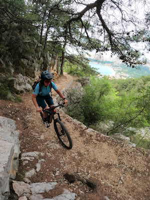
An MTB outing from Baška on Krk island, Croatia, crossing the barren, moon-like landscape in the south of the island.
I chose to ride in the opposite direction from the itinerary shown on the tourist maps I had. This gave a pleasant climb followed by a trail descent straight into the centre of Baška.
Loading map...
Nearby routes
Other routes whose starting points are near this route. This does not imply similar difficulty or terrain.